Hike Through Hong Kong's Natural Beauty
8 hiking trails in Hong Kong to check out
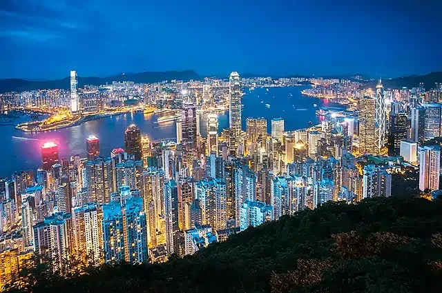
Hong Kong is a city that's known for its towering skyscrapers, bustling streets, great shopping, and amazing food. But there is more to that in Hong Kong. What people often miss when visiting Hong Kong is the many hiking trails and what they have to offer. Whether you are looking for a relaxing, scenic hike or something that is very challenging, there is something for you.
Victoria Peak Circle Walk
🌋 Difficulty: Easy | Distance: approx. 3.5 km | Duration: < 1 hour

The Victoria Peak Circle Walk is probably the easiest and most accessible hike in Hong Kong. The trail loops one round around Victoria Peak, one of Hong Kong’s most iconic landmarks. The entire trail is relatively short at just about 3.5 km with only about 100m of slopes — you probably can consider this a walk instead of a hike. The trail can be completed in about an hour. Not only is it easy and short, you will still get some of the best views of the city skyline on this trail, making it a perfect option for those who are looking to just shed off some of your calories after binging on the amazing food that Hong Kong has to offer. Since the trail is a loop, you can head in either direction and it will bring you back to the same place.
🗺️ **Route: **Peak Galleria → Lugard Road → Harlech Road → Peak Galleria
🚆 How to Get There: Ride up the Peak Tram from the Peak Tram Lower Terminus 10 minutes away from Central MTR Station. Or Take Bus No. 15 from Central Bus Terminus. Or simply hike up to Victoria Peak from Central MTR Station (approx. 60 minutes)
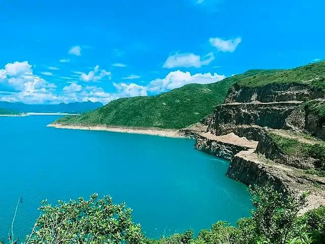
High Island Reservoir Geo Trail
🌋 Difficulty: Easy | Distance: approx. 4.3 km | Duration: 3 hours

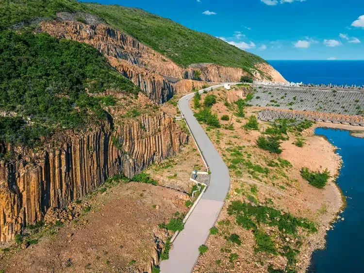
The High Island Reservoir Geo Trail is another picturesque hike that takes you around Hong Kong's largest reservoir. The Geo Trail is just 4.3km, and is part of the longer 100km MacLehose Trail that goes from Sai Kung to Tuen Mun. This trail offers stunning views of the reservoir, as well as the surrounding mountains and forests. Along the way, you will also see hexagonal columnar jointings of volcanic tuff, sea caves, and sea stacks formed over the last few centuries. Of course, if you are up for something more challenging, feel free to extend your hike to cover more of the MacLehose Trail.
🗺️ Route: High Island Reservoir East Dam → Biu Tsim Kok → Hexagonal Rock Columns → Fault Breccia Belt → Distorted Rock Columns → Sea Cave
🚆 **How to get there: **Take bus 92 from MTR Diamond Hill Station Exit C2 to Sai Kung Town. From Sai Kung, either take minibus 9A from Pak Tam Chung, or get on a taxi to High Island Reservoir East Dam.
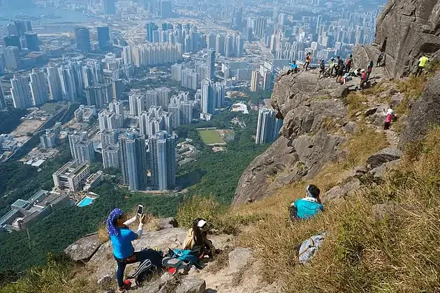
Dragon’s Back
🌋 Difficulty: Easy - Intermediate | Distance: approx. 8.5 km | Duration: 4 hours

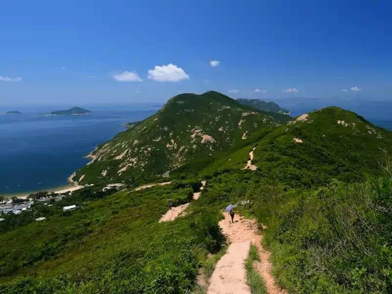
This 8.5-kilometer trail from Shek O Peninsula Viewing Point to Big Wave Bay Beach is considerably Hong Kong’s most popular hiking trail. The trail will take approximately 4 hours to complete, and while there are some steep slopes, most people shouldn’t have a problem completing it. The trail takes you through lush forests, over steep ridges, and along sandy beaches. The highlight of the hike is undoubtedly the panoramic view of Shek O Beach, Big Wave Bay, and the South China Sea.
🗺️ Route: Shek O Peninsula Viewing Point → Shek O Peak → Dragon’s Back & Pottinger Gap → Big Wave Bay
🚆 **How to Get There: **From MTR Shau Kei Wan Station Exit A3, walk to the Shau Kei Wan Bus Terminus. Take bus 9 or the red minibus with the sign “Shek O” to the To Tei Wan stop on Shek O Road.
Tai Mo Shan
🌋 Difficulty: Intermediate | Distance: approx. 4 km | Duration: 2 hours

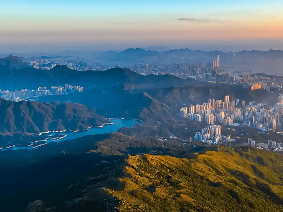
There are multiple ways that can take you up to an altitude of 957 metres above sea level at the highest mountain in Hong Kong. The summit of Tai Mo Shan is fenced off, but there are many spots near the top that are perfect for watching the sunset amidst a sea of clouds, should the weather permit. The trails all have varying difficulties, and most people will try to go on Section 8 of the MacLehose Trail for their hike up Tai Mo Shan. But if you are looking for something that is relatively easier and good for families, go on the trail that starts from the Rotary Park and passes by the Country Park Visitor Centre. This trail is approximately 4km and relatively safe, despite some steep slopes along the way.
🗺️ Route: Rotary Park → Tai Mo Shan Country Park Visitor Centre → Tai Mo Shan Road & Tai Mo Shan Lookout → Weather Radar Station
🚆 How to Get There: Walk to the bus stop on Tai Ho Road North from MTR Tsuen Wan Station Exit A. Take bus 51 to the Country Park stop where you’ll find the entrance on Tai Mo Shan Road.
Lan Tau Peak Trail
🌋 Difficulty: Intermediate | Distance: approx. 6 km | Duration: approx. 4 hours

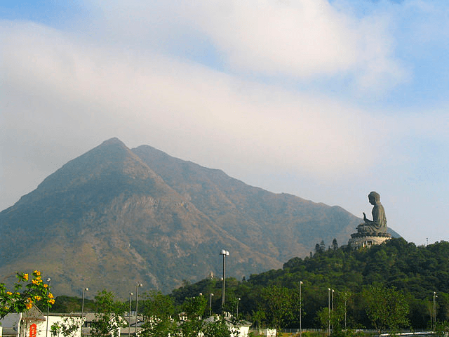
Lantau Island is best known for their Citygate Outlet Mall and Buddhist establishments like the Po Lin Monastery, Tian Tan Buddha, and Wisdom Path. But Lantau Island is also home to one of the best hikes in Hong Kong. Instead of taking the cable car up to the peak to see the Big Buddha, why not consider hiking up instead? The Lantau peak is the second highest peak in Hong Kong, just after the Tai Mo Shan. Similarly, there are various routes up to the peak, each having its own level of difficulty. One of the the easiest and most popular route up to the peak will be by going on the Lantau Trail Section 3, which is part of the longer 70-km Lantau Trail that traverses the entire island. Lantau Trail Section 3 starts from Pak Kung Au and ends by the Big Buddha in Ngong Ping. Th route has a lot of steps and is rather steep, but you will get amazing views of the island and nearby airport as you hike up to the peak. The Lantau Peak also looks very different across the different seasons, so you may want to consider going up the peak on different trails in different seasons.
🗺️ Route: Pak Kung Au → Lantau Peak → Wisdom Path → Po Lin Monastery & Tian Tan Buddha
🚆 How to Get There: Head to the bus terminus from MTR Tung Chung Station Exit B, take Bus 3M or 11 to Pak Kung Au bus stop.
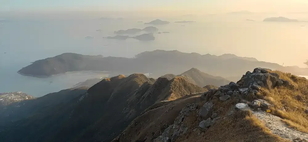
MacLehose Trail
🌋 Difficulty: Difficult | Distance: 100 km | Duration: ~6 days

If you are up for something adventurous, the MacLehose Trail is a 100-kilometer hiking adventure that takes you across Hong Kong. To complete the entire trail at a leisurely pace, an average person will probably take about 6 days, though it is possible to complete it in a shorter time if you were fit. This trail is divided into 10 sections, each of which offers its own unique challenges and rewards. Sections 2 and 4 are the sections that are considered the most challenging to hike. The MacLehose Trail consists other shorter trails such as the High Island Reservoir Geo Trail and Tai Mo Shan Trail — which you could consider taking if the full 100km is too intense for you.
Kowloon Peak and Suicide Cliff
🌋 Difficulty: Difficult | Distance: approx. 5 km | Duration: approx. 2.5 hours

Standing at 602m, the Kowloon Peak, also known as Fei Ngo Shan, is the tallest peak in Kowloon. It is part of the Ma On Shan Country Park, and has one of the most dangerous cliffs in Hong Kong - the Suicide Cliff. It’s named Suicide Cliff not because people commit suicide there, but rather, because hikers had been seriously injured on the trail that goes directly up to the cliff. That said, the hike up to Suicide Cliff does not have to be dangerous - you can take a longer and safer route to the Suicide Cliff via the Kowloon Peak. There are multiple routes up to Kowloon Peak, one of the easiest being the one from Fei Ngo Shan Road. The hike up to Kowloon Peak is relatively easy and the tricky part would be the climbing from Kowloon Peak to Suicide Cliff where the routes are narrower - though you will be fine as long as you are careful and take the necessary precautions. From the Suicide Cliff, you can the same route back down to Fei Ngo Shan Road, or carry on the trail to Sha Tin via Elephant Hill.
🗺️ **Route: **Fei Ngo Shan Road → Kowloon Peak → Suicide Cliff → Kowloon Peak → Fei Ngo Shan Road
🚆 **How to Get There: **From City One MTR Station, take minibus 65A or 65K to Wong Nai Tau Bus Terminus
West Kau Nga Ling
🌋 Difficulty: Difficult | Distance: approx. 9 km | Duration: approx. 6 hours

The Kau Nga Ling, which literally means Dog’s Teeth Ridge, is considered to be the hardest hike in Hong Kong. As its name suggest, the hike consists thin and sharp peaks that resemble a dog’s teeth. It has been included in the Hong Kong government’s list of hiking ‘black spots’, which are spots to avoid due to its danger. The Dog’s Teeth Ridge is made up of three ridgelines, the Middle Dog Teeth Range, East Dog Teeth Range and West Dog Teeth Range, of which the East is the easiest and West being the most difficult with the steepest. You can also expect to have to use your hands to help you climb up rocks along the way. But as much as it is challenging, you are also promised great views along the way. The three ranges are connected and you can choose to cover more than one range, but most people end their hike at Lantau Peak.
⚠️ If you are an inexperienced hiker, do not try this hike. Consider going on the Lantau Peak Trail from Pak Kung Au instead if you would like to hike up to Lantau Peak.
🚆 **How to Get There: **Head to the bus terminus from MTR Tung Chung Station Exit B, and take Bus 11 or 23 to Shek Pik Police Station.
Stay Connected with a Nomad eSIM for Hong Kong
No matter where your hiking adventures takes you, stay connected with a Hong Kong travel eSIM from Nomad. Nomad offers affordable data eSIMs in over 200+ destinations worldwide, — including Hong Kong.
Choose from a variety of local, regional, and global data plans, buy and install your travel eSIM before you fly, and get connected to a local network the moment you land. Running out of data mid-trip? Simply purchase an add-on in the Nomad app.
Planning a trip to Hong Kong? Get an Hong Kong eSIM to stay connected during your trip.